$110,000
$125,000
12.0%For more information regarding the value of a property, please contact us for a free consultation.
1 Fat Purse Rd Idaho Springs, CO 80452
11.96 Acres Lot
Key Details
Sold Price $110,000
Property Type Vacant Land
Sub Type Unimproved Land
Listing Status Sold
Purchase Type For Sale
Subdivision Miner'S Candle
MLS Listing ID 4441673
Sold Date 12/14/21
HOA Y/N false
Originating Board REcolorado
Annual Tax Amount $1,324
Lot Size 11.960 Acres
Acres 11.96
Property Description
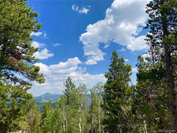
The historic Fat Purse, Montezuma and Puritan Lodes are a contiguous and stacked 11.96 acre assemblage featuring magnificent Divide views. These three patented claims tower over the 1-70 corridor that silently winds a couple thousand feet or so below. Suggested access this time of year will require AWD, and likely 4WD in the winter months. Mature aspens and stoic pines populate this 'VIEW' property. Observing the GIS map, you'll notice an access road that travels through more than 450 ft of the property(s). On the westerly side of the property, there's a nice parking area where you could plant a few chairs, soak in the expansive views, inhale the crisp pine infused air and contemplate how to make these lovely properties yours. Like many properties in this area, mineral rights are retained by another owner, but most will agree that the ground to the star filled skies are where it's at. Download the OnX Hunt app onto your phone and go 'offline' in Idaho Springs. Be sure not to close the app when exploring the beautiful route to the Fat Purse, Montezuma and Puritan. You'll take Trail Creek past the Phoenix Mine eventually hanging a sharp right onto Miner's Candle. Chart your route from there by following the light blue line illustrated on the GIS map in this listing's photos. A GIS in hand along with OnX Hunt will get you there. Interested parties are responsibie for confirming zoning and allowed use of the property. Enjoy the adventure discovering the Fat Purse assemblage!
Location
State CO
County Clear Creek
Area Suburban Mountains
Zoning M1
Direction Print maps from County GIS. Download Onx Hunt. Depart Idaho Springs onto Stanley Rd. then take a left on Trail Creek Rd. Cell reception will be spotty, so that's why we encourage you to take OnX Hunt offlne.
Exterior
Street Surface Dirt
Building
Lot Description Wooded, Sloped, Rock Outcropping, Mountains
New Construction false
Schools
School District Clear Creek Re-1
Others
Senior Community false
Special Listing Condition Private Owner
Read Less
Want to know what your home might be worth? Contact us for a FREE valuation!

EWN Real Estate Group
ewn@ewn-re.comOur team is ready to help you sell your home for the highest possible price ASAP


EWN Real Estate Group


